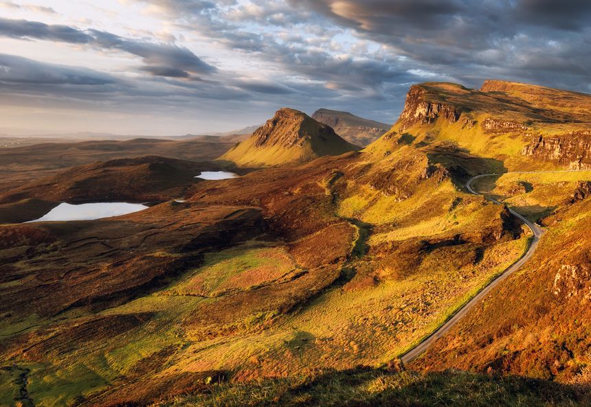
The UK has a diverse range of hills and mountains
Such natural landforms are often referred to by regional terms such as fells (Lake District, from Old Norse), tors (South West England, from Old Celtic), bens (Scotland, from Gaelic beinn), and downs (Southern England, from Old English dun). The Pennines, a major upland area in Northern England, are often called the "backbone" of England.
Regional Names for Hills in the UK
Different historical and linguistic influences mean the same geographical feature can have many names across the UK.
- Fell: Used extensively in the Lake District and Northern England, derived from the Old Norse word fjall for mountain.
- Tor: Common in Devon and Cornwall (e.g., Dartmoor and Bodmin Moor), referring to a rocky outcrop on a hilltop.
- Ben/Beinn: An anglicised version of the Scottish Gaelic word for mountain, prevalent in the Scottish Highlands (e.g., Ben Nevis, Ben Lomond).
- Càrn: A Gaelic term used in the Eastern Highlands for a hill or a pile of stones.
- Sgùrr: A term for a pointed or craggy peak, especially on the west coast of Scotland.
- Pen: From Old Cumbric and modern Welsh, meaning "top" or "head" (e.g., Pen-y-ghent in the Yorkshire Dales).
- Moel: A Welsh word often used for a bare hill (e.g., Moel Famau).
- Downs: In Southern England, chalk hills are often called Downs (e.g., the North Downs or South Downs).
This table has been copied out of a Google sheet and pasted in:-
| Hill Name | Area / Region | Height |
| Allt yr Esgair | Black Mountains | 1288 ft, 392.60 m |
| Banc Llechwedd-mawr | Central Wales - Pumlumon | 1837 ft, 560.00 m |
| Bryn Arw | Black Mountains | 1263 ft, 385.00 m |
| Cadair Idris - Penygadair | Cadair Idris | 2929 ft, 892.70 m |
| Carn Gafallt | Central Wales - Elan Valley | 1529 ft, 466.00 m |
| Cefn yr Ystrad | Brecon Beacons | 2025 ft, 617.30 m |
| Ben Nevis | Nevis Range, Fort William | 4,411 ft, 1,344.5 m |
| Ben Macdui | Cairngorms | 4,295 ft, 1,309 m |
| Braeriach | Cairngorms | 4,252 ft, 1,296 m |
| Ben Lawers | Lawers Hills (Perthshire) | 3,983 ft, 1,214 m |
| Lochnagar | The Mounth (Aberdeenshire) | 3,789 ft, 1,155 m |
| Ben Lomond | Loch Lomond & The Trossachs | 3,196 ft, 974 m |
| The Cobbler (Ben Arthur) | Arrochar Alps | 2,900 ft, 884 m |
| Ben Cleuch | Ochil Hills | 2,366 ft, 721 m |
| Suilven | North West Highlands | 2,400 ft (approx), 734 m |
| Arthur's Seat | Edinburgh (Central Lowlands) | 823 ft, 251 m |
| Carrauntoohil | MacGillycuddy's Reeks, County Kerry | 3,409 ft, 1,039 m |
| Beenkeragh | MacGillycuddy's Reeks, County Kerry | 3,314 ft, 1,010 m |
| Caher | MacGillycuddy's Reeks, County Kerry | 3,284 ft, 1,001 m |
| Cnoc na Péiste | MacGillycuddy's Reeks, County Kerry | 3,241 ft, 988 m |
| Brandon Mountain | Dingle Mountains/Brandon Group, County Kerry | 3,123 ft, 952 m |
| Lugnaquilla Mountain | Wicklow Mountains, County Wicklow | 3,035 ft, 925 m |
| Galtymore Mountain | Galtee Mountains, County Limerick/Tipperary | 3,012 ft, 918 m |
| Baurtregaum | Slieve Mish Mountains, County Kerry | 2,792 ft, 851 m |
| Slieve Donard | Mourne Mountains, County Down | 2,789 ft, 850 m |
| Mullaghcleevaun | Wicklow Mountains, County Wicklow | 2,785 ft, 849 m |
end of post
/Passle/65cbd8b7a663ca0e2ed0192d/SearchServiceImages/2025-12-01-12-23-50-147-692d88d601280cd27d74c5f8.jpg)

/Passle/65cbd8b7a663ca0e2ed0192d/SearchServiceImages/2025-11-17-18-44-52-945-691b6d24e44a5af8ac0e7afd.jpg)
/Passle/65cbd8b7a663ca0e2ed0192d/MediaLibrary/Video/Transcoded/2025-11-10-17-02-01-036-Kattenarchivevid/thumbnail/2025-11-10-17-02-01-036-Kattenarchivevid.0000000.jpg)